
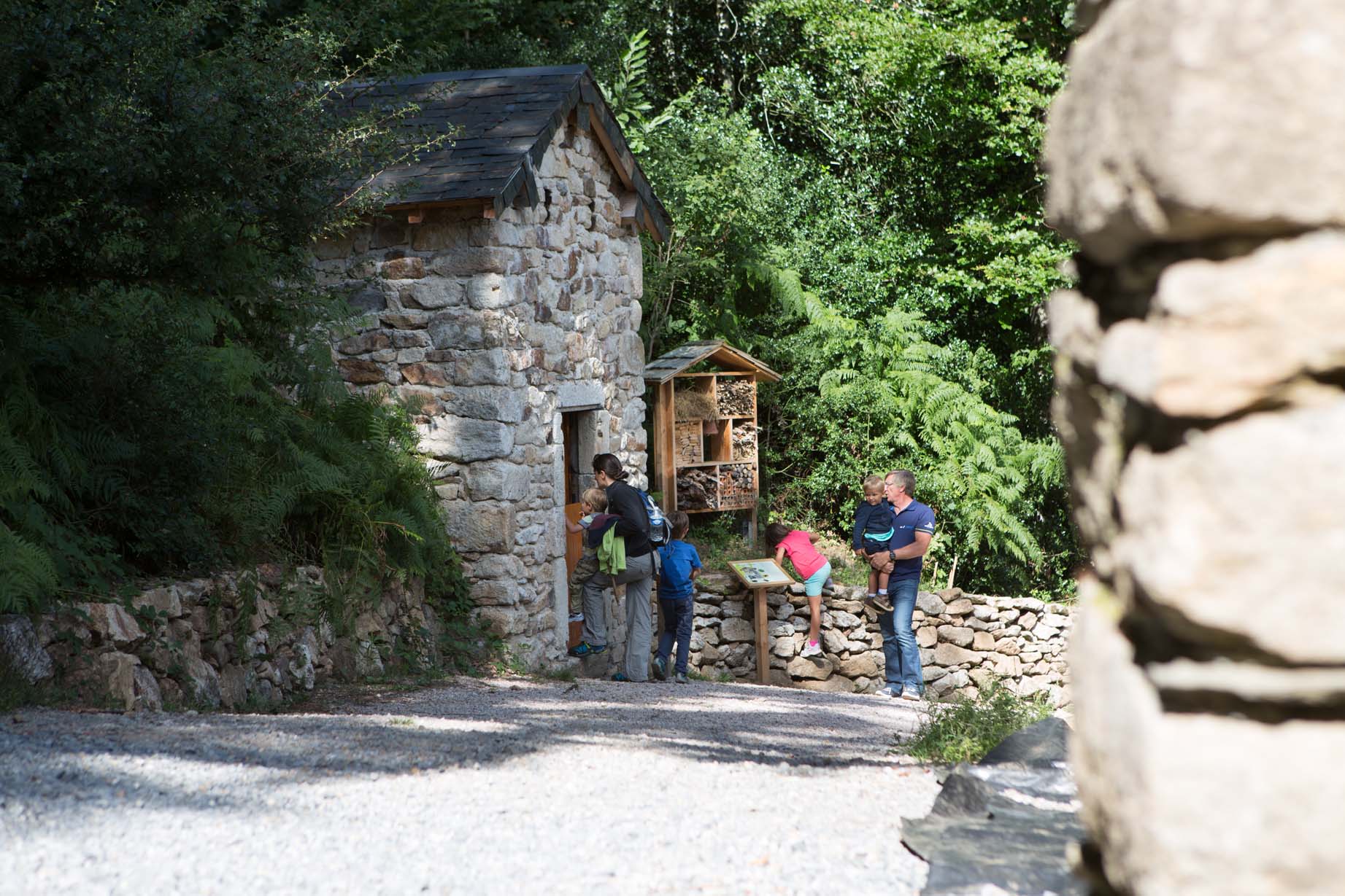
Follow a trail lined with reconstructed stone landmarks: cairns, dry-stone huts and more. Along the way, enjoy magnificent views over the Monts de Lacaune.
If you hike this trail between May and September, take time to stop at the Maison de Payrac. Depending on the season, you can enjoy refreshments and local specialities.
Around this former farmhouse, the forest has become a true paradise for children, with wooden cabins to explore, farm animals to meet and a mountain garden to discover.
Along the route, interpretation panels introduce the different tree species found in the area.
On 15 August, local farmers celebrate the Payrac Fair, with demonstrations and traditional activities throughout the day.
If you hike this trail between May and September, take time to stop at the Maison de Payrac. Depending on the season, you can enjoy refreshments and local specialities.
Around this former farmhouse, the forest has become a true paradise for children, with wooden cabins to explore, farm animals to meet and a mountain garden to discover.
Along the route, interpretation panels introduce the different tree species found in the area.
On 15 August, local farmers celebrate the Payrac Fair, with demonstrations and traditional activities throughout the day.
Practical informations
Geolocation
Latitude :
43.65505
/ Longitude :
2.756281
Description
1
(Start/Finish) From the car park, take the path opposite. On your left, you will notice a jasse with a broom-thatched roof, which can be visited.
At the first junction, turn left. You will discover the Michel Demange Geodrome, presenting the different types of stone found in the region. Continue along the path to the capitelle (former shepherd's shelter).
Point 2 et point 2 retour :
Turn right along the roadside. Continue for 1 km to the watering trough and handcrafted picnic table.
Point 2 retour :
Cross the road and continue to the right along the path called "La Bretelle du Chasseur", marked by a cairn.
At the wooden hide, turn right. Along the way, discover an impressive collection of traditional traps once used in the countryside.
You then reach the foot of the Michel Demange Geodrome. Take the wide track to the left, passing an iron charcoal kiln.
At the next junction, you will see reconstructions of an iron ore furnace, a charcoal kiln and a watering trough.
At the first junction, turn left. You will discover the Michel Demange Geodrome, presenting the different types of stone found in the region. Continue along the path to the capitelle (former shepherd's shelter).
Point 2 et point 2 retour :
Turn right along the roadside. Continue for 1 km to the watering trough and handcrafted picnic table.
Point 2 retour :
Cross the road and continue to the right along the path called "La Bretelle du Chasseur", marked by a cairn.
At the wooden hide, turn right. Along the way, discover an impressive collection of traditional traps once used in the countryside.
You then reach the foot of the Michel Demange Geodrome. Take the wide track to the left, passing an iron charcoal kiln.
At the next junction, you will see reconstructions of an iron ore furnace, a charcoal kiln and a watering trough.
3
Turn left towards the road. Cross it and continue on the track opposite.
After 500 metres, go down a few steps to the road, follow it to the right until another capitelle.
After 500 metres, go down a few steps to the road, follow it to the right until another capitelle.
4
Leave the road and follow the grassy path on the left (not shown on the IGN map).
At the cross on the summit, turn left to rejoin the path bordered by dry-stone walls.
You will reach the reconstruction of a window that actually exists in the forest opposite and is known as the "Wolf's Window" (Fenêtre du Loup).
Continuing along the track, you will come to another stone marker made of two stones. It is a reconstruction of a regional monument called "Pierre sur Autre", which marks the boundary between three municipalities.
A little further on, a standing stone completes this series.
Continue along the small descending path to the road.
Cross the road at the bend, cross the bridge and take the path climbing opposite.
Pass a cairn to reach the upper road. Turn left and continue to the next cairn.
At the cross on the summit, turn left to rejoin the path bordered by dry-stone walls.
You will reach the reconstruction of a window that actually exists in the forest opposite and is known as the "Wolf's Window" (Fenêtre du Loup).
Continuing along the track, you will come to another stone marker made of two stones. It is a reconstruction of a regional monument called "Pierre sur Autre", which marks the boundary between three municipalities.
A little further on, a standing stone completes this series.
Continue along the small descending path to the road.
Cross the road at the bend, cross the bridge and take the path climbing opposite.
Pass a cairn to reach the upper road. Turn left and continue to the next cairn.
5
Leave the road and climb the steep track on the right to reach the junction passed on the outward route.